Bridges of the Brandywine

Bridges of the Brandywine
The September 2nd flood on the Brandywine seriously damaged the footbridge that gives access to Alapocas Park from the Highlands side of the river. It is now closed. That bridge, and all of the other bridges over the Delaware section of the Brandywine, appear on a pictorial map of the Brandywine I published in 2006.

The footbridge, number 9 on the map, originally served the Bancroft Mills, as did a second bridge downstream, number 10, viewable by hiking along the riverfront trail in Alapocas Park..
I researched the pictomap by photographing the existing bridges, and researched the now gone historic bridges at the Delaware Historical Society and the Hagley Museum & Library. I painted individual watercolors of the bridges depicted and assembled the map digitally. The key to the bridges in the upper right corner is modeled on Delaware's historical markers that you see along our streets and roads. The iron girder pattern on the border emulates structural bridgework.
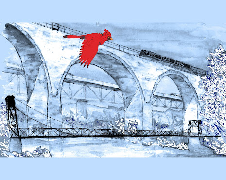
I've painted and adapted the view of the "Three Bridges" (numbers 11, 12, & 13 on the map) several times, earlier as a commissioned painting, and later as a Christmas card with a winter setting.
I was pleased with the map, but it was not a marketing success. The remainders are under a bed.


Comments
Post a Comment